National Parks | June 2014
IN FLIGHT (but really driving)
Travel time: 18 hours, 59 minutes (without traffic)
Miles covered: 1,208
Entertainment of note: road trip mix featuring Fleet Foxes, Beach House, Mumford & Sons, and Serial podcast (season one)
POST FLIGHT
Travel time: 5 days
States visited: 3 (Arizona, Utah, and, briefly, Nevada)
Miles covered: 26 (on foot)
Near-death experiences: just the one
Prologue:
For those of us afflicted with the highly contagious travel bug, there is a certain amount of strategy involved in selecting a vacation destination. As a result, one might rank the more exotic and adventurous destinations higher on their list. Destinations not for the faint of body or heart. And Europe, for all its history and architecture, beauty and bounty, is accessible. You need not the folly and energy of youth to properly explore the continent. For many years, young adults have thriftily come of age there, taking summers and semesters to explore its cities via hostels and rail cars. But perhaps it is preferable to see once you have the perspective and disposable income that comes with age. But what do I know. I’m guilty of spending a hazy two months on this rite of passage at the tender age of twenty-four.
For those uninterested is choosing from column a or column b, I am here to offer a simple domestic solution: the oft-overlooked U.S. National Parks. Yes, the parks are clichéd and crowded, but they have been declared federally protected nature reserves for a reason. They are beautiful and approachable, and, best of all, easy to plan and execute in a short period of time. The mathematically sound ratio of fun to convenience is off the charts. In June, I took a weekend and three vacation days with my family to celebrate my own father and the natural beauty of these United States.
Chapter One:
In planning a road trip hitting the noteworthy National Parks in Utah and Arizona, we agonized over the logistics. In order to minimize travel time and maximize sights, I flew from San Francisco to Las Vegas where my family, driving from Southern California, picked me up. From Nevada, we drove to the furthest point of Moab, Utah, and spent the next four days weaving our way back towards California.
For those of you who haven’t had the pleasure, the Las Vegas Airport is basically a casino with runways and more expensive drinks. Banks of slot machines and impossible to find exits complete the likeness. I finally reunite with my family on the second floor of the adjacent parking structure where arrivals are met. Together, we drive (approximately 6.5 hours) to Moab, Utah, the home of Arches National Park. In a silly reversal of road trip roles, my sister and I trade-off driving and riding shotgun for the duration of the drive, while our regressing parental unit sits in the backseat dividing their time between playing games on their iPhones, napping, and snacking. They playfully nag us with the chorus of “Are we there yet?”
Night one accommodations are the modestly glamorous tents of Moab Under Canvas. Along North Highway 191, the unassuming white tents are easy to miss. If you’ve hit Arches National Park or downtown Moab, which we did, you have gone too far. For me, Moab Under Canvas is the best of both worlds: offering the opportunity to be nature-adjacent and then able to retreat to a warm tent and comfortable bed when it’s time to turn in. Our cozy tent had four twin beds lining the canvas walls. There was a dresser, mirror, and a couple battery-operated lamps. I believe the tents were also equipped with power-strips for charging your various electronic devices. Depending on the needs of your party, numerous tent configurations are available.
We arrived quite late that evening. The moon was almost full, beginning to wax (or is it wane?), and shone brightly on the campsite and surrounding red rock mountains. Restrooms and showers are available in converted double-wide trailers with indoor plumbing and running water. Guests are allowed use of communal grills and campfire pits. There are some refreshments available for purchase at the main check-in cabin. They offered complimentary tea and coffee. It is advisable to bring your own provisions, and use the facilities onsite. We toast beers and marshmallows under the stars.
If you plan a trip of this nature, the National Park pass is a great investment at $80. The pass grants free entry to the pass-holder and up to three companions into any national park for twelve months from purchase date. You can even add a second authorized user! They offer discounted rates for seniors and U.S. military. With entrance fees averaging $20, the pass pays for itself during this trip. And we still have the rest of the year to use it for weekend trips to Muir Woods, Joshua Tree, Yosemite, etc.
Chapter Two:
We regrettably check out of Moab Under Canvas, leaving many of its features untested during our wonderful and brief stay. We head into town for the most important meal of the day, grabbing egg mcmuffins and hash browns at McDonald’s. I’m lovin’ it. Today we are white water rafting down the formidable Colorado River, a body of water spanning 1,450 miles and most-famously responsible for the formation of the Grand Canyon. The half day excursion curated by Red River Adventures begins at 8:00 a.m. with a short meeting before busing to the river. Our guide provides color commentary on the way. At the terminus of our tour, we help unload the rafts, are fitted with life vests, learn the dos and don’ts of paddling, and participate in a safety briefing. It’s still early in the season, so the river is moving faster that it will later in the summer. As you may have noticed from the lack of spontaneity in my trips, I’m a planner. I like adventure, but remain averse to risk at home and abroad. As the briefing goes on and we are assigned to boats and guides, I’m beginning to get nervous. But there are young kids doing this (another family of four with young daughters, representing us during our younger and less vulnerable years) and we are strong swimmers. We have experienced guides and personal flotation devices. I tell myself it’s just adrenaline. We’ll be fine, right? The four of us pile into a raft with our tanned, shirtless, nipple-pierced guide at the helm. In the beginning, the ride is exhilarating and lots of fun, driving head on into mild rapids, bouncing down the river, getting wet and wild on this all too real log ride.
We approach one of the more technical sections. Our guide says he tipped his kayak here just last week when out solo. Oh, dear. Everything happens so fast. We hit a rapid, the raft tips. I’m sitting on the submerged edge and get bumped out. My mom, sister, and dad fall, too. The boat does not capsize and the guide is able to pull my dad back in the boat. My mom, sister, and I are adrift with more rapids to navigate ahead. I see the terror on their little bobbing faces. I feel guilty for making us do this, guilty for not being able to help them. I cannot even help myself. I’m heading for a particularly scary rapid, swirling and churning white caps. I take a deep breath, release the grip on my oar (technically not advisable), and go under. I’m wearing a life jacket. I don’t fight. I’m pushed around, as if diving under a big wave while swimming in the ocean. When I pop up, I am beyond the rapids. I made it through. I am exhausted, and use all my remaining energy to swim to another boat in our fleet. The guide pulls me in. I sit in the back, with my legs hanging over the edge, while this boat takes me down the river. I think I saw my sister and mom pulled into another boat, but I can’t be sure. The worst part is, the ride is not over. We find a quiet spot to stop and regroup. The four of us (mom and sister were rescued by another raft) have to get back in our boat and continue down the river to the half-day pickup location. There is one last set of rapids, which we fortunately get through, soaked and a little shell-shocked but otherwise unscathed. We unload and take a family photo. We force smiles, hiding terror, expressing an overwhelming sense of relief. I am grateful to be back on solid ground, grateful to be alive.
Our guide recommended Rio Sports Bar for lunch. Utah is quite strict when it comes to the sale of alcohol. Luckily, this bar was serving. I order a pint with my sandwich, never needing a drink more than I do now. Over lunch, still dazed, we hardly speak to each other.
During the raft trip, professional photographers were poised along the riverbanks with cameras at the ready to photograph the tours coming through. The final photos can be viewed a few hours later at Moab Action Shots. This spot is also an ice cream shop. We indulge and cast votes for our favorite images. Christmas card, anyone? In this promised land of eastern Utah, I silently vow to never raft again. We change into dry clothes and, for the remainder of the day and trip, stick to dry land.
That afternoon, we explore the natural wonders of Arches National Park. In a park that contains the most concentrated collection of natural sandstone arches in the world, none is more alluring than Landscape Arch. Arch lovers particularly favor this hike because it passes by two arches on the way to Landscape. Hikers have the option of continuing to Devils Garden to see five more arches over the course of this five-mile (round trip) route. Alternatively, the hike from Devils Garden Trail to Landscape Arch is an easy two-miler. A couple things to consider are heat and crowds during the middle of the day.
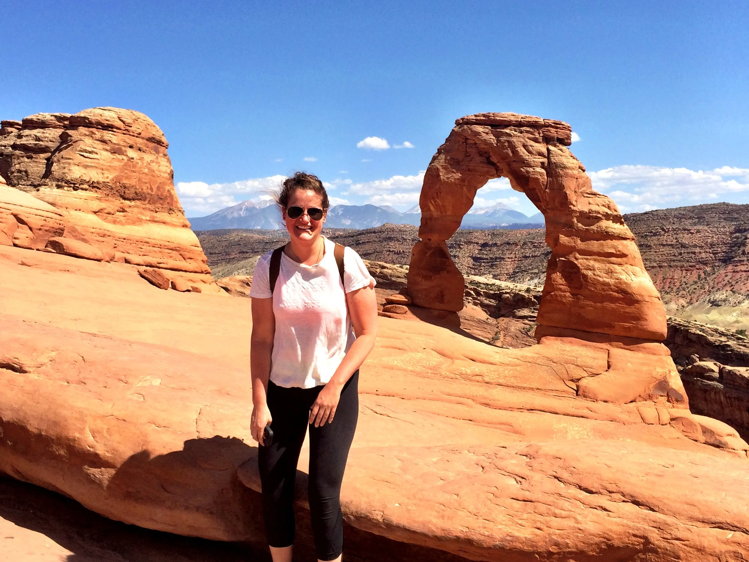
We decide to hike to my personal favorite, Delicate Arch (about 3 miles round-trip). From the visitor center, you drive 12.3 miles up Park Avenue and turn right. Continue an additional 1.2 miles and turn left into the parking area for Delicate Arch Trail. The trail oscillates between wide undefined paths up sheer rock inclines and flat sandy walkways. We face dry heat and determined winds. The final push goes along a rock ledge for about 200 yards. Weather permitting, you are allowed to hike right up to the arch, posing beneath its impressive crescent, which some may recognize as the adornment on Utah’s license plates. The original sandstone fin was gradually worn away by weathering and erosion, leaving the arch. As its formation would indicate, the arch is very exposed to the elements (strong gusts blowing wind and sand), as are those hiking to its location. I stay back, feeling neither particularly sure-footed nor brave. Not today.
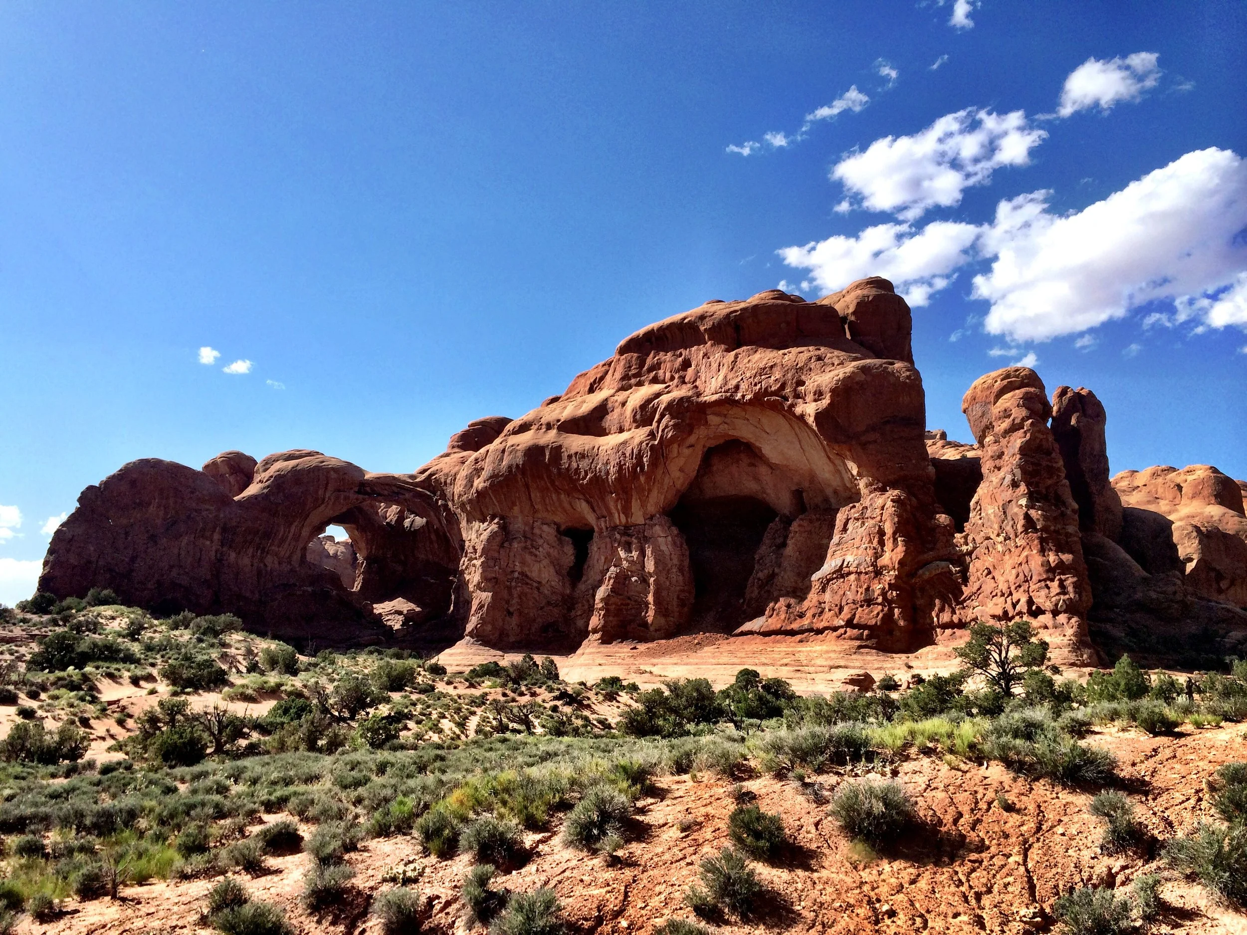
After the hike, we tour the Windows section of the park. To get there, drive 9.2 miles up the Arches Entrance Road, and then take the first right after Balanced Rock. You will follow this road 2.7 miles to its end at a roundabout (with plenty of parking) for the Windows Trail. This is a leisurely trail. Visitors can easily extend their excursion to include Double Arch, the Parade of Elephants, and Turret Arch should they have the time and the desire. Double Arch, which is especially striking, is so named because it consists of two arches that share the same stone foundation for both of their outer legs. Double Arch was formed by downward water erosion from atop the sandstone, rather than from side-to-side water erosion.
From Arches, we make the 4½ hour drive to Page, Arizona. At the adequate Days Inn & Suites, I welcome sleep, wanting nothing more than for this day to be a memory.
Chapter Three:
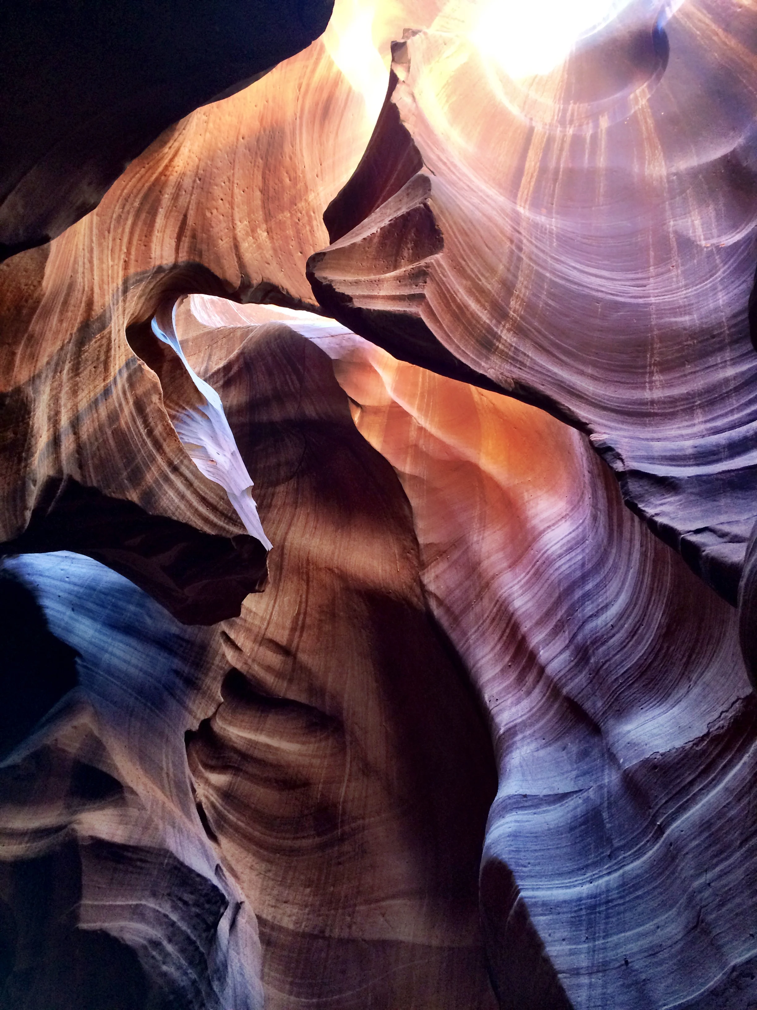
The hotel provides free continental breakfast. We stock up on fruit and yogurt and granola, and depart for the slot canyons. Our tour of Antelope Canyon is scheduled for 9:30 a.m.-11:30 a.m. They recommend arriving at the office (22 South Lake Powell Blvd.) at least 20 to 30 minutes prior to departure time. The office is extremely crowded and disorganized. We check in and wait to be called. Depending on the size of your group, you are divided accordingly into off-road vehicles. This particular entrance to the upper slot canyon is located on an American Indian Reservation and, as such, heavily regulated by Navajo Nation. Per tribal law, all visitors to Upper and Lower Antelope Canyon must be accompanied by a guide. I found our particular guide to be rude and rushed, making for an unpleasant experience; still, the incredible scenery and photographs make it worthwhile.
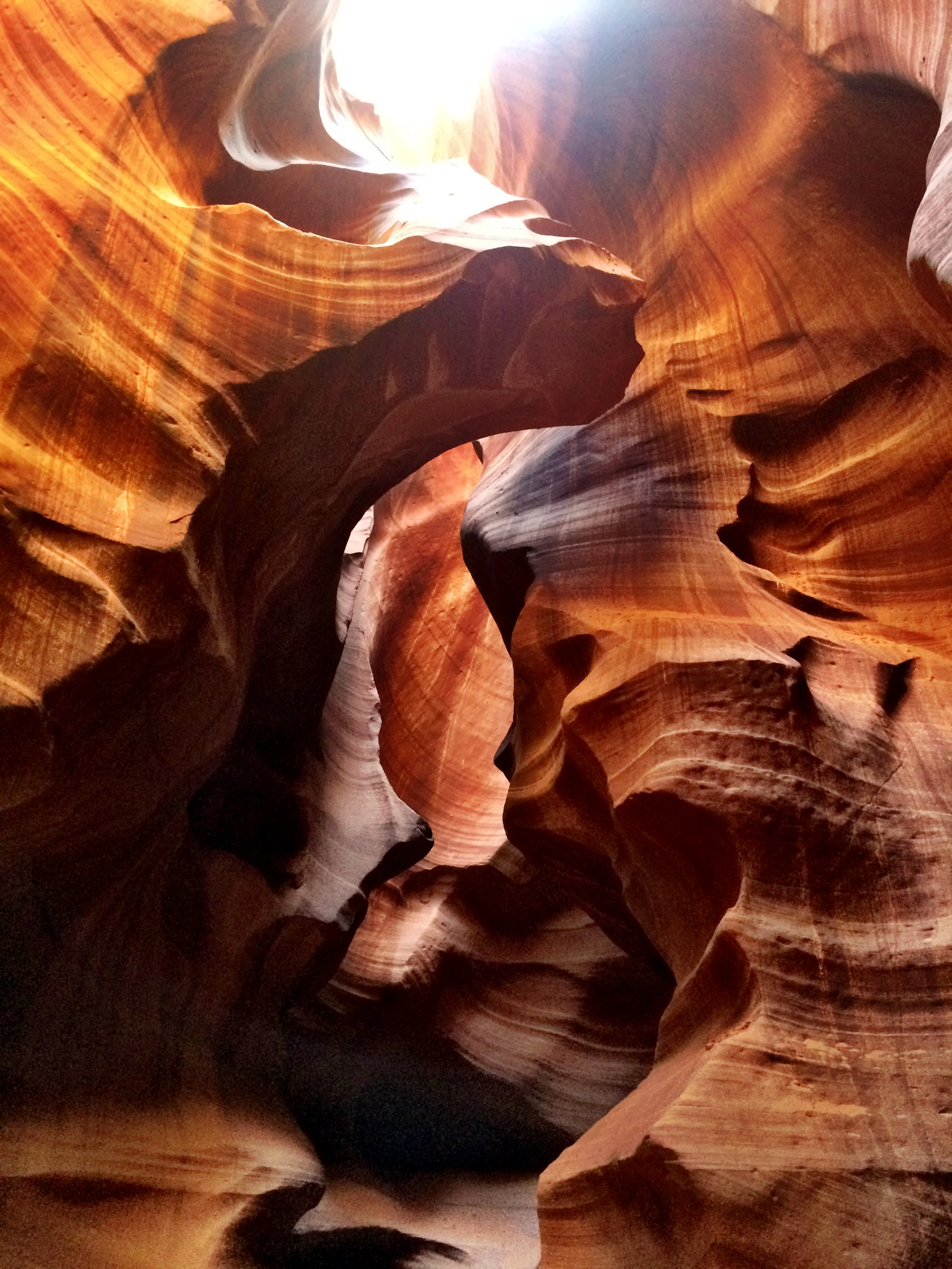
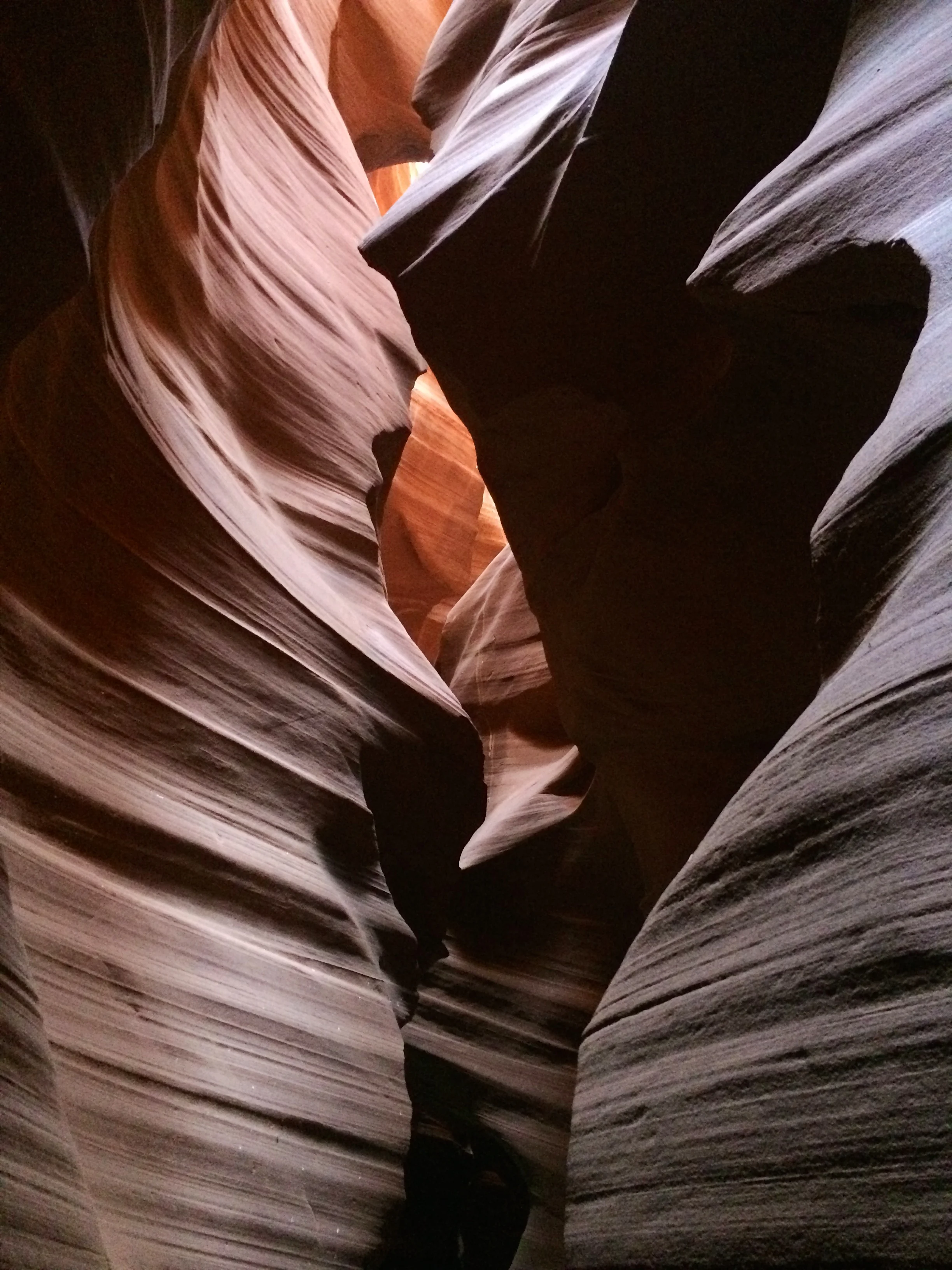
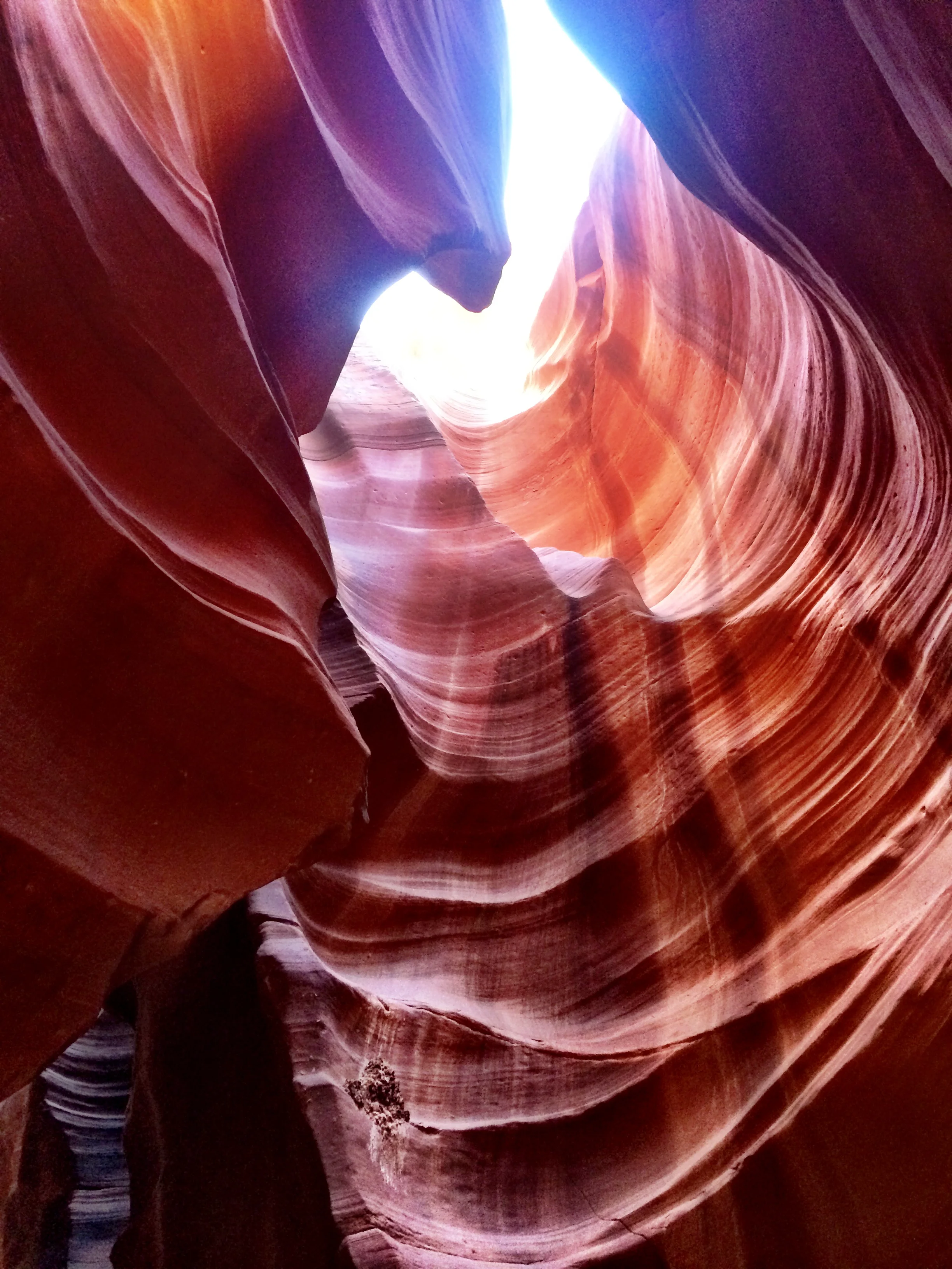
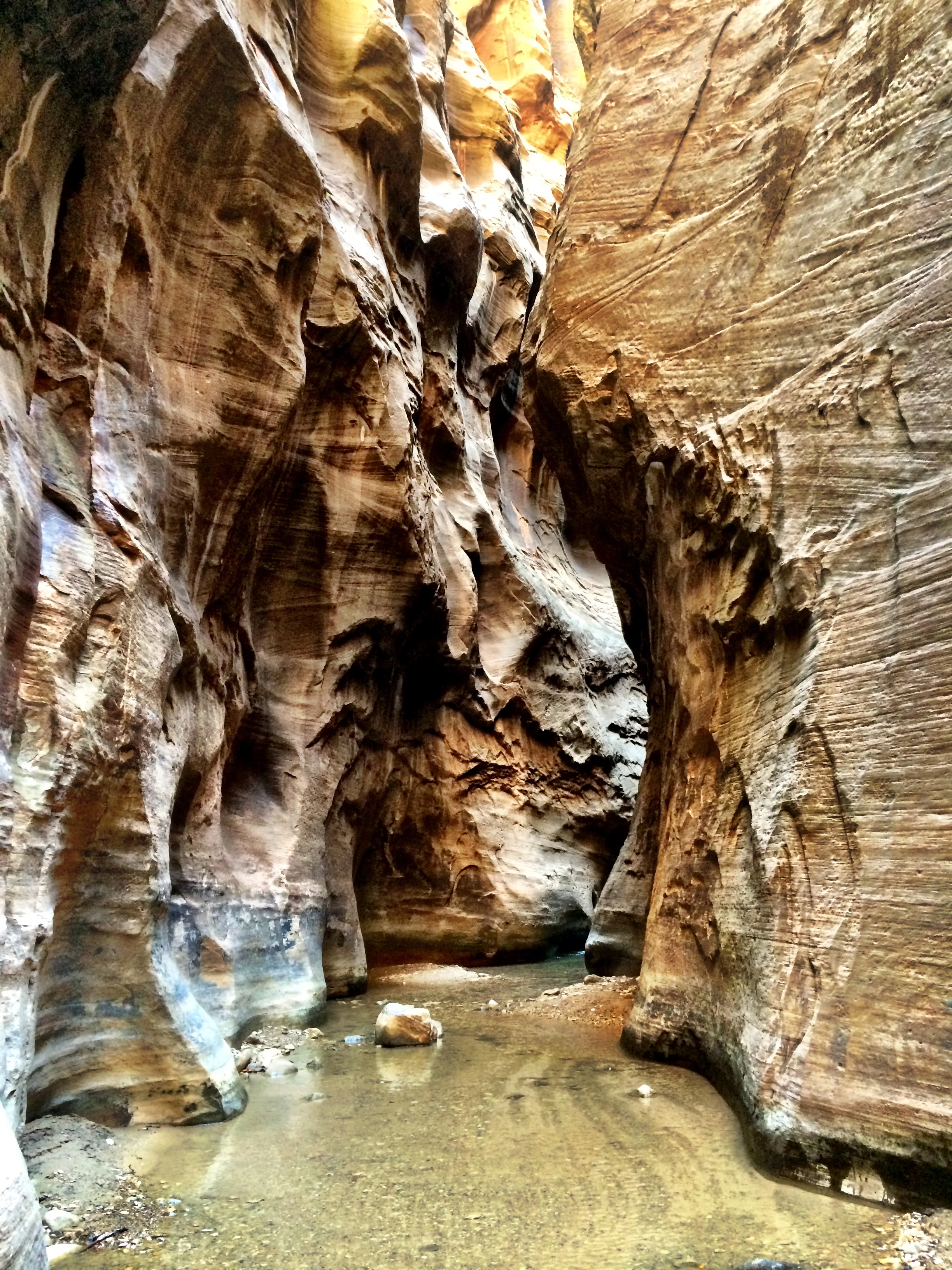
A slot canyon is a narrow crevice sliced through a mesa by rushing water. Some canyons measure less than a yard across at the top but drop a hundred feet or more from the rim to the natural floor. Slots are cut and scoured by water and wind with the striations of the sandstone becoming almost incandescent. Seen from the surface, a slot canyon appears as a slash. From within you find a palette of colors transmuted by light filtering down from above and bouncing from wall to wall.
Antelope Canyon includes two separate and equally photogenic slot canyons: upper (aka the crack) and lower (aka the corkscrew). Prior to the installation of metal stairways, visiting the lower canyon required climbing along pre-installed ladders. Despite these renovations, it is a more difficult hike than Upper Antelope. It is longer, narrower in spots, and even footing is not available in all areas. At the end, the climb out requires several flights of stairs. The lower canyon is in the shape of a “V” and shallower than the Upper Antelope. Lighting is better in the early hours and late morning.
For all these reasons, we are visiting Upper Antelope Canyon. Its entrance and entire length are at ground level, requiring no climbing. In addition, beams (shafts of direct sunlight shining down from the slight openings in the top of the canyon) are much more common in Upper than in Lower. Beams occur most often in the summer months, as they require the sun to be high in the sky.
The slot canyon is absolutely gorgeous. The canyons have been carved by years of erosion. The walls are sanded smooth, exposing all the layers and colors of sedimentary deposits over time. Tour groups of about fifteen people are constantly coming through the narrow path of the slot canyon. You have to hang back to get an unpopulated photo, finding the lull between groups. My sister and I were definitely the naughty kids in class, constantly being reprimanded by our brusque and impatient guide for not keeping up. There is no serious hiking or climbing involved, just an easy walk on a sandy, mostly level canyon floor.
The conditions are dusty to say the least. I suggest taking a page from Mad Max: Fury Road and pack hats, glasses, and maybe even a bandanna or kerchief. The short tour (you really only have about 30 minutes in the slot canyon) concludes back at the tour office, where souvenirs are available for purchase. We stop for a quick, satisfying lunch at nearby Fiesta Mexicana.
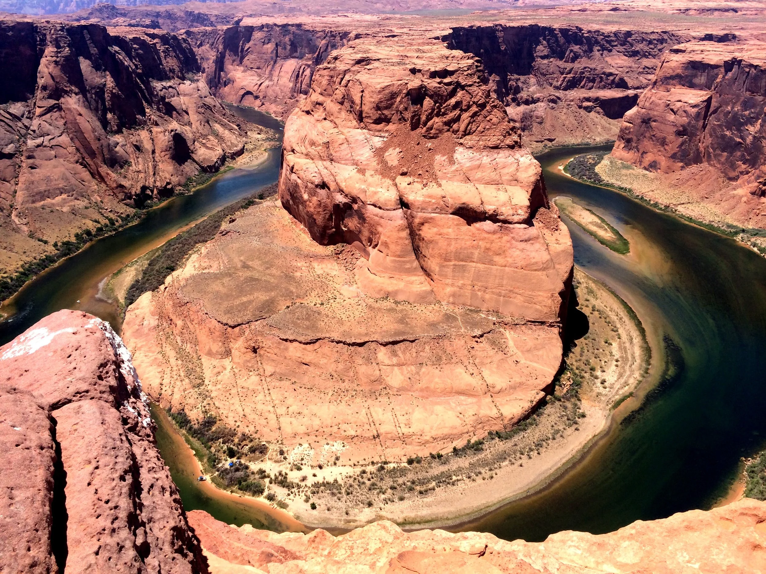
Today’s drive is not terrible, only two and a half hours to Zion National Park in Springdale, Utah. On the way, we take a brief pit stop and photo op at Horseshoe Bend. Just five miles outside of Page, follow the signs on Highway 89. From the parking lot/turnout, there is a short hike to the viewpoint. I hiked in flip flops, but I do recall the sandy ground being difficult to traverse, similar to walking on a beach. The view is amazing. The overlook, while slightly less terrifying when taken in from the comfort of one’s stomach, offers many different vantage points from which to view this curve in the mighty Colorado River. This particular serene section runs four miles south of the Glen Canyon Dam and seven miles north of mile zero of the Grand Canyon.
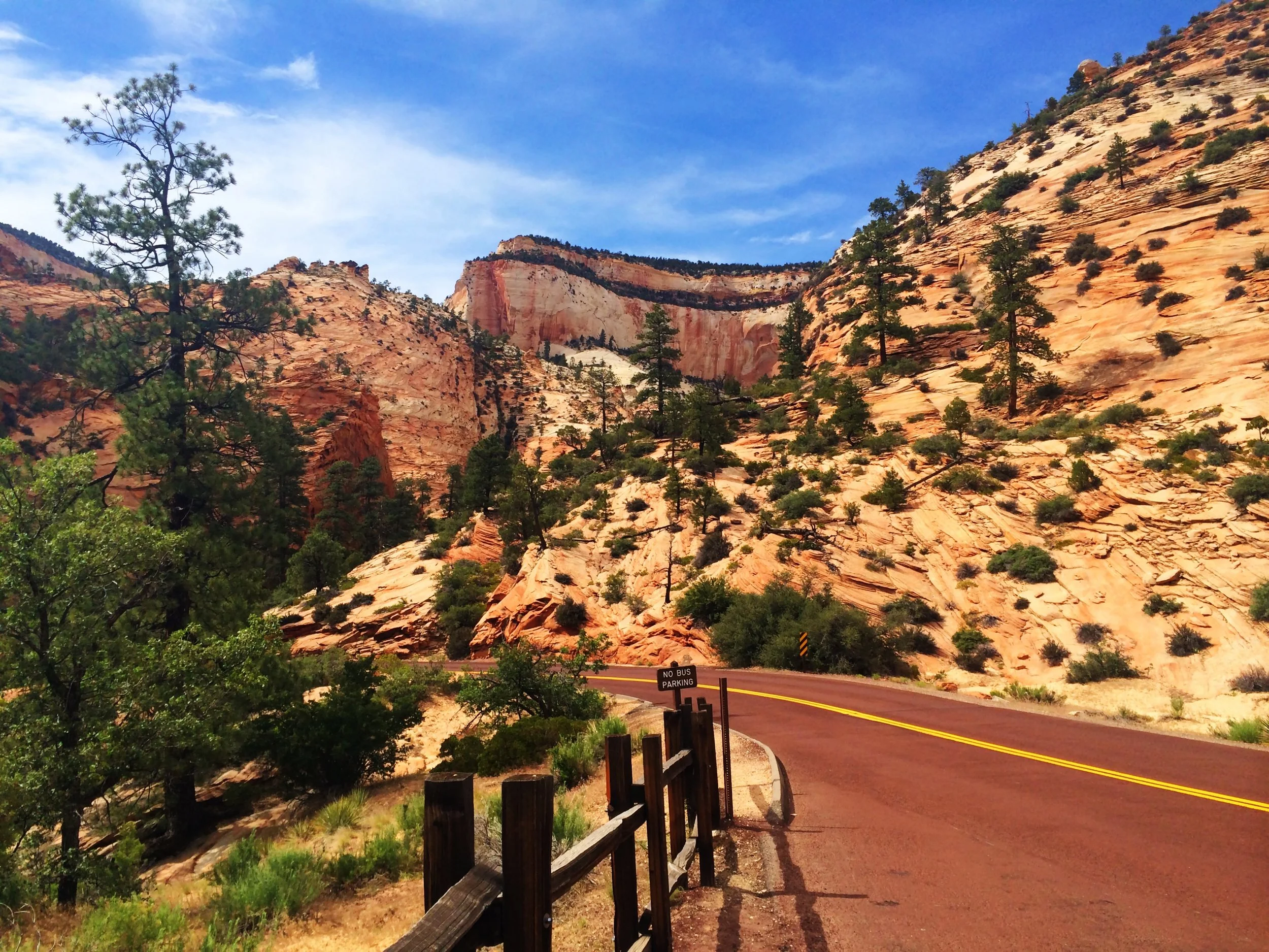
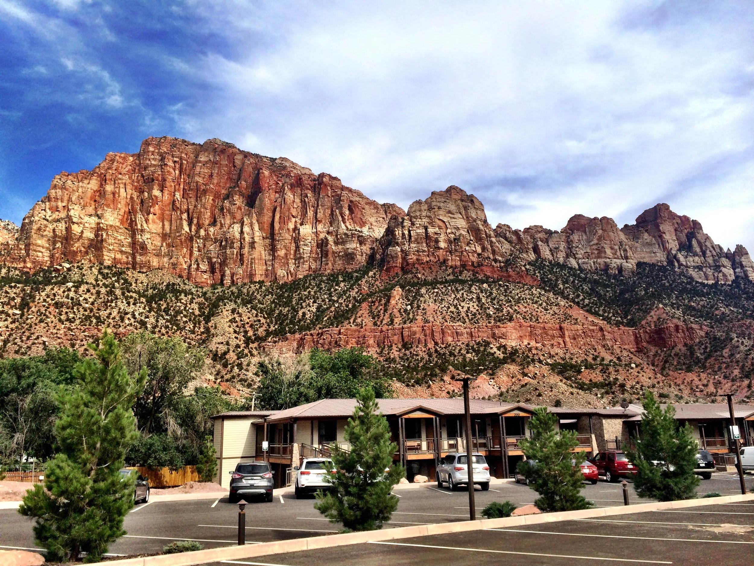
We enter Zion through the eastern entrance, which can be reached by driving US-89 to the U-9/Zion-Mt. Carmel Highway. The 1.1-mile long Zion-Mt. Carmel tunnel opens to the Zion Canyon Scenic drive, which leads to some of the most popular landmarks in the park. We continue south through the park, as much as unauthorized vehicles are allowed, stopping at each and every lookout and eventually exit through the south gate. Our accommodations (La Quinta) are located about one mile south of this entrance in the town of Springdale. The prime location also offers easy access to many shops and eateries within walking distance. That afternoon, we relax in our hotel’s refreshing pool and rejuvenating hot tub.
Chapter Four:
Our wonderful hotel offers a comprehensive free breakfast, including egg and sausage sandwiches and fresh waffles. Unlike Yosemite, for example, vehicles are not allowed to drive through Zion during the extended summer season of April through October. Canyon Junction is as far as you can take a car during those months. During the winter, when the park shuttle does not run, you are able/required to drive directly to the trailheads where parking is available. Outside the park, the free Springdale Shuttle stops at nine locations throughout the town. This shuttle stops just across the street from our hotel, and will take you as far north as the Zion Canyon Visitor Center, where the transfer between loops is made. The free Zion Canyon Shuttle stops at nine locations in the park, offering a pre-recorded history of the park that you will quickly memorize and tire of. During the busy summer season, the shuttles regularly fill to standing room only capacity, often turning away passengers, but run frequently enough that the wait is not too long.
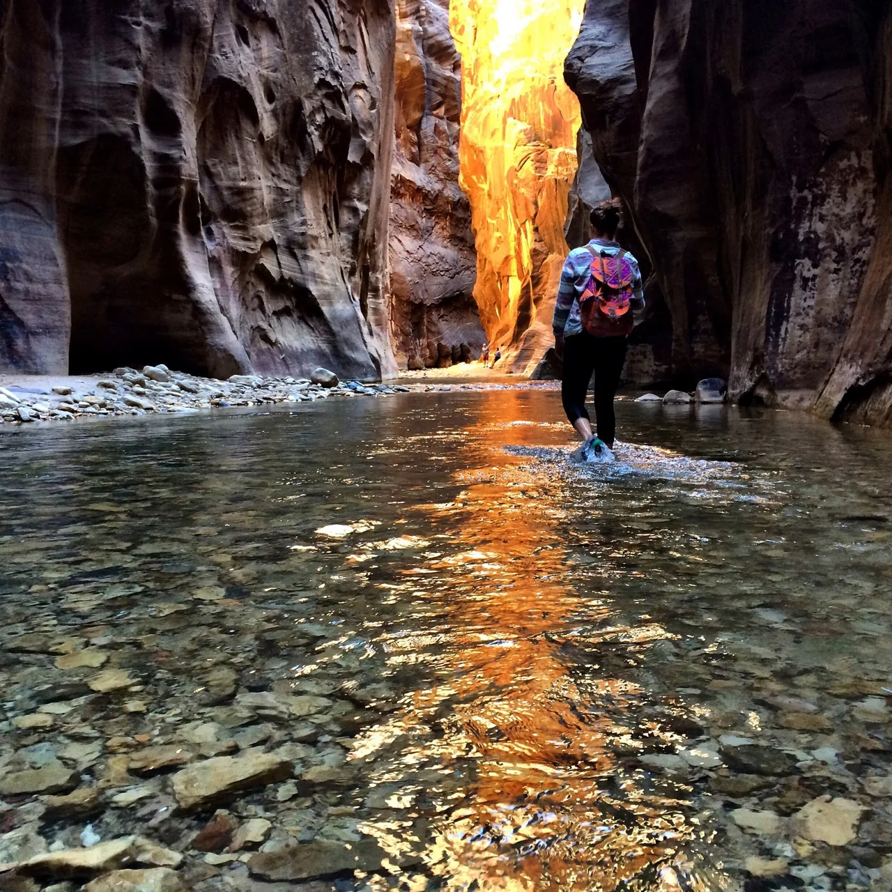
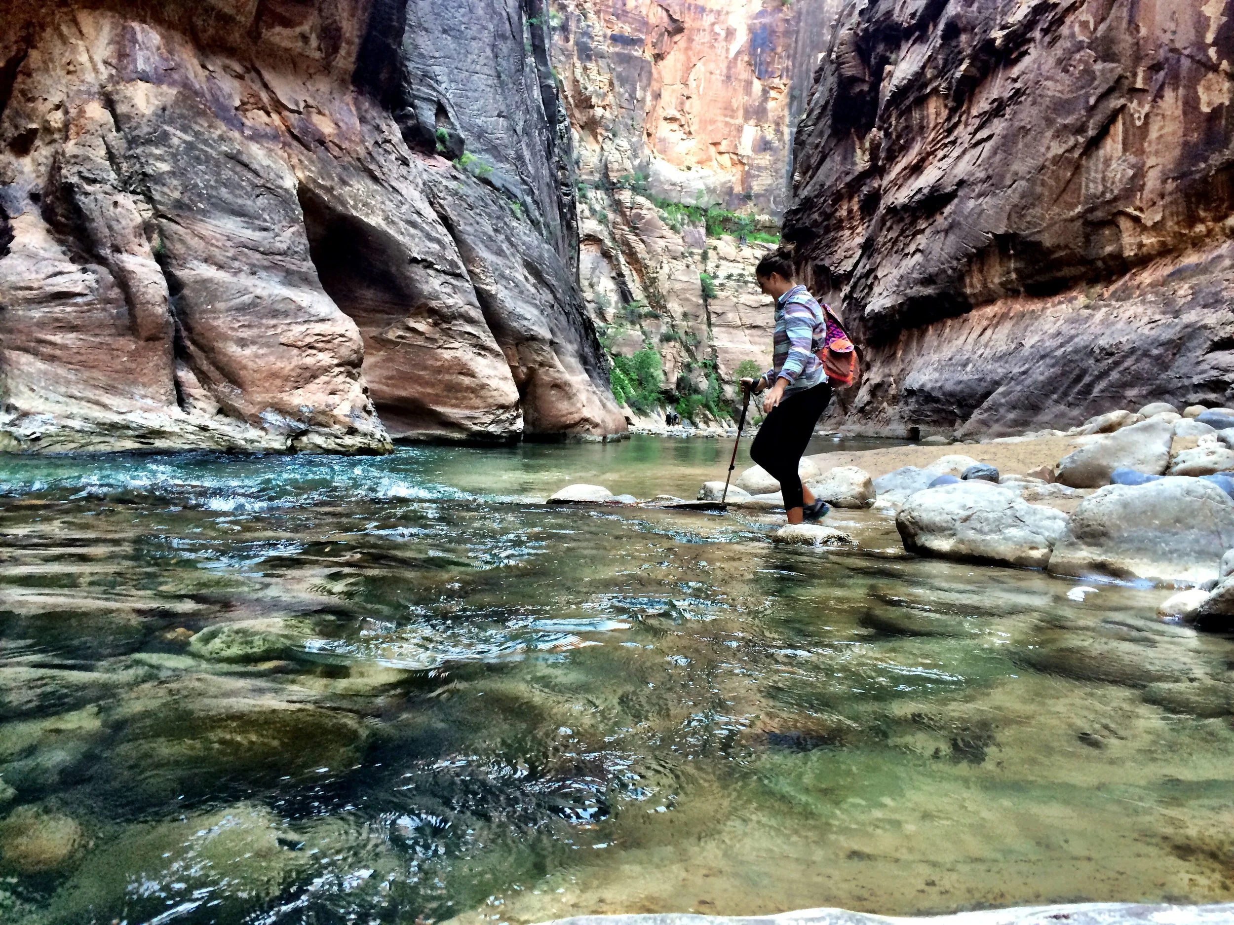
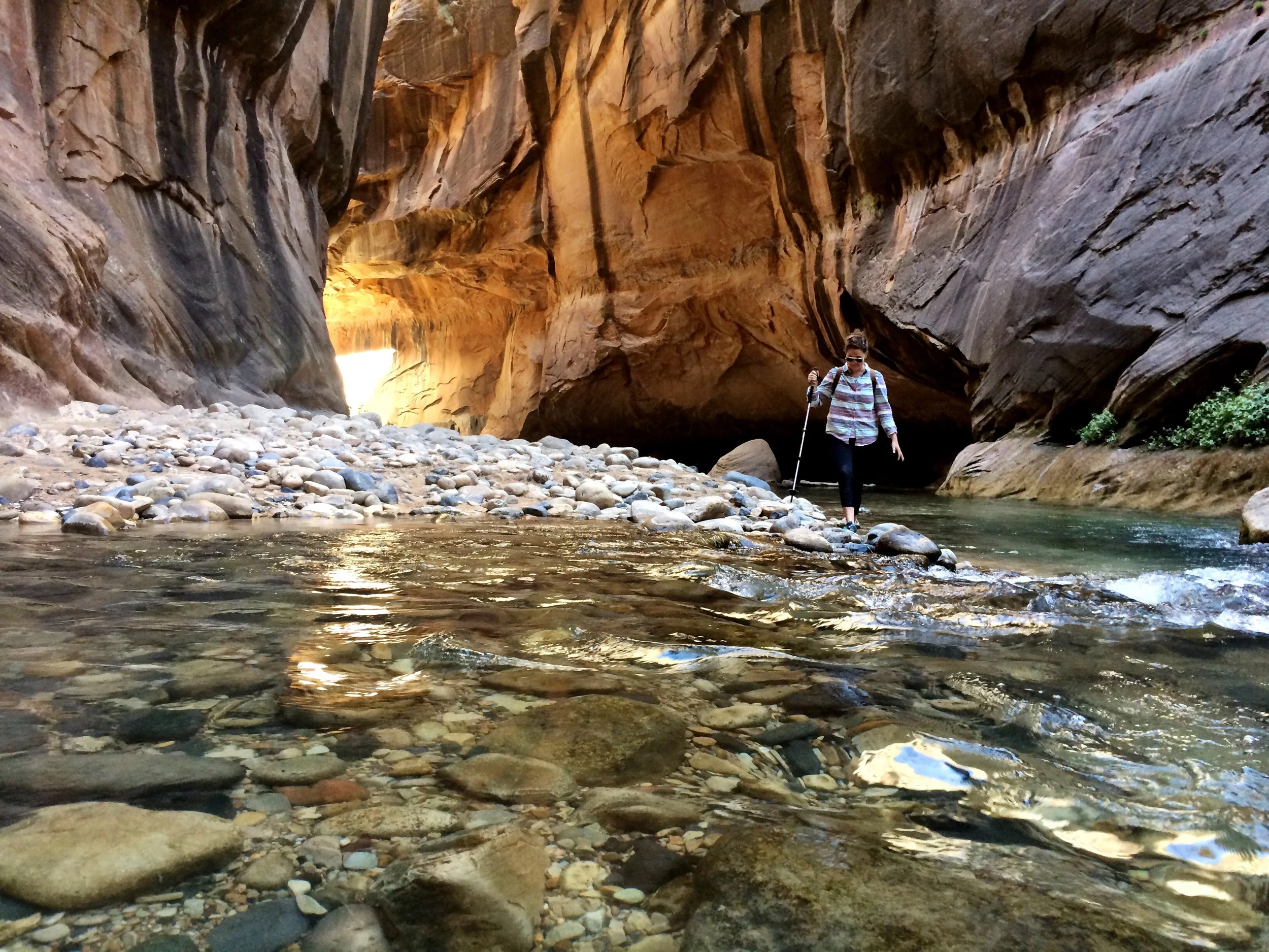
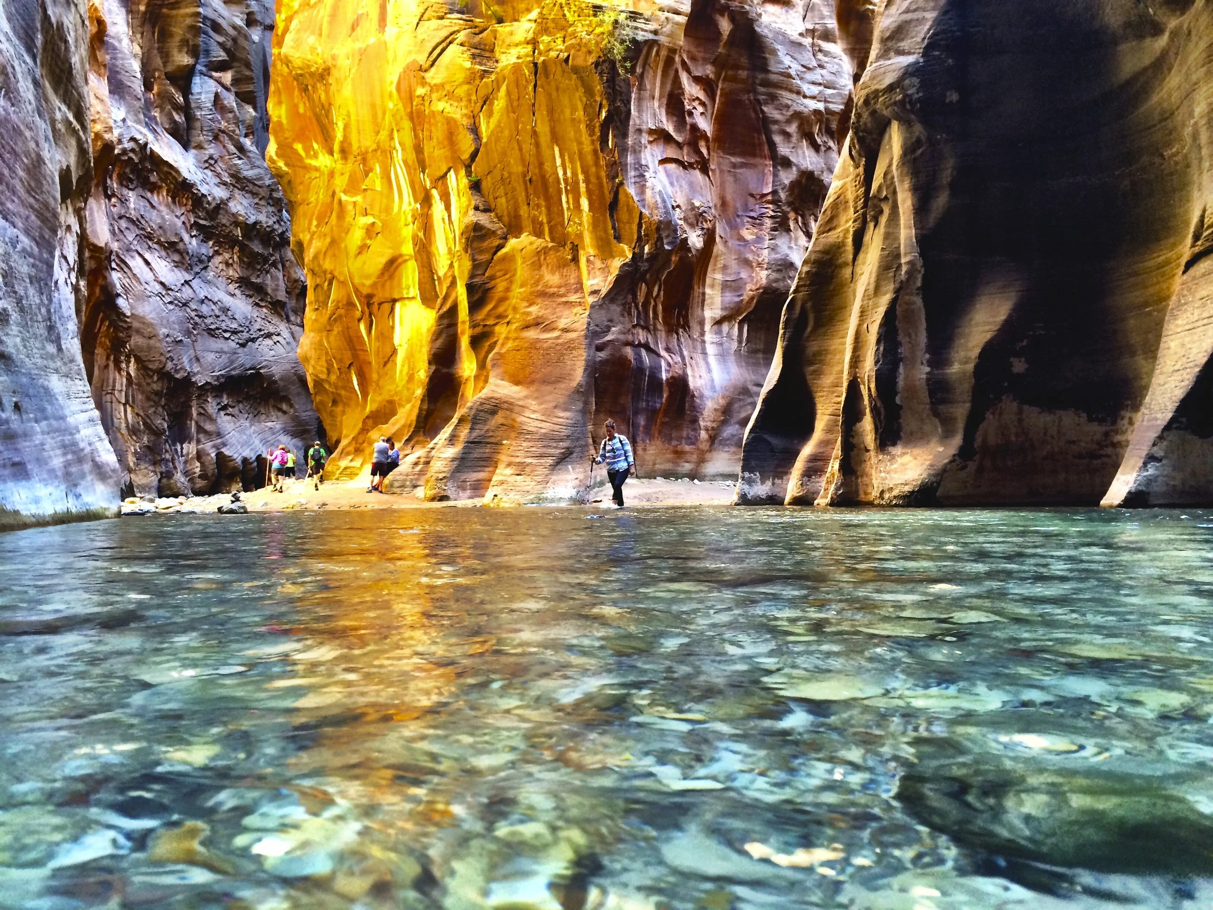
Today we are hiking The Narrows. The simplest route (both physically and logistically) is bottom up. You can ride the Springdale shuttle to the VC, then take the Zion shuttle to the Temple of Sinawava. From that stop, there is a one-mile paved Riverside Walk. This path is wheelchair and stroller accessible. From the end of this path, you quite literally wade up the Virgin River. There is no formal destination, and you return the same way you came. Many hikers try to reach Orderville Canyon, a tributary creek approximately two hours upstream from the end of the paved trail (2.5 miles from the shuttle stop). It is another 2.5 miles upstream from Orderville to Big Spring, making the round trip hike up to Big Spring and back to the shuttle stop 10 miles. As you might predict, wading downstream is significantly easier and faster than the hike up.
The alternative to bottom up is, of course, top down. Hiking this direction is allowed by permit only. Permits can be acquired through a calendar reservation system. Sometimes last minute drawings are an option. This route can be done as a slogging day hike or more leisurely explored as an overnight backpacking trip. The Subway is the most notable sight on this route.
We get an early start, and just as the idiom says, catch the worm in the form of one of the few parking spots near the park’s Canyon Junction shuttle stop. The hike is fantastic – challenging enough to be interesting, but still so much fun. I endorse hiking poles for balance! If you begin early enough, there are communal wooden hiking sticks at trailhead. I feel like a broken record, but I cannot stress enough the perks of hiking early. The lack of both people and direct sunlight in the riverbed make for beautiful photos. We wade just past a fork, presumably Orderville Canyon, before turning around. Again, unlike spawning salmon, you are under no reproductive obligation and free to proceed upstream as near or far as you wish. The only limit is Big Spring, where non-permit holders must turn around. On our way out, as the sun and temperature rise, the site becomes a full-fledged water park with kids and parents, alike, splashing around.
A few less than fashionable suggestions: wear waterproof shoes or sneakers you don’t care about. It also behooves you to dress in layered clothing. You are fording a river for the duration of the hike, with cold water sometimes reaching as high as your thighs. And in the morning, the tall walls of the gorge throw shade on The Narrows.
One other thing: in addition to your glutes and quads, please exercise caution and common sense. For obvious reasons, this hike is highly susceptible to flash flooding. Pay close attention to weather conditions and consider rescheduling if rain is in the forecast.
After the hike, we take the shuttle back to our car. Having already checked out of the hotel, we freshen up and move on. This time around, our accelerated schedule does not leave much time for our bodies to linger. But mentally, I have flagged Zion as a destination worth another visit.
Next up: Bryce Canyon at approximately one hour and forty-five minutes away. Bryce is known for its hoodoos (those stalagmite-looking rock spires), beautiful sunsets, and dark night skies perfect for stargazing. We will have just missed the full moon, but if you happen to be there during that time of the month, moonlit night hikes are available.
I booked all accommodations online and unwittingly. We were really lucky. All the hotels (and glamp tents) were great. We settle in at the Best Western before proceeding to Bryce to spectate. The layout of Bryce is amusing, like a very small Grand Canyon. You do not know it’s there until you are right at the edge. Our best laid plans to watch the sunset is easier said than done, for the nearest lookout faces east; but magic hour does bathe the hoodoos in its flattering light.
Chapter Five:
We enjoy a complimentary and delicious breakfast buffet in the lodge’s spacious dining hall before heading back to Bryce for a bit of hiking and sightseeing. Navajo Trail is one of the more popular trails and can be combined with the Queens Garden Trail to create a longer, more varied loop. Full and fatigued, we stick to the moderate(ish) 1.3 mile Navajo Trail Loop, which begins at Sunset Point and heads into Bryce Amphitheater through a slot canyon where fir trees stretch to reach the sunlight above. This route offers the opportunity to walk among the sculpture garden of towering hoodoos. Its final ascent (initial descent for some, since you can hike the loop in either direction) out of the canyon makes use of several short and steep switchbacks as you exit the Wall Street section, named for its tall canyon walls resembling skyscrapers. Park elevations reach over 9,000 feet. Even mild exertion may lead to lightheadedness and nausea. As we hiked, I definitely felt the altitude. Make sure to carry plenty of water since the body is more susceptible to dehydration at high altitude.
The park’s main road leads past the expansive horseshoe-shaped Bryce Amphitheater, a hoodoo-filled depression lying below the Rim Trail hiking path. There is an 18-mile scenic drive to Rainbow Point with access to 13 viewpoints along the route. It has overlooks at Sunrise Point, Sunset Point, Inspiration Point and Bryce Point. Prime viewing times are around sunup (amazing when viewed from Bryce or Inspiration Points) and sundown. All of the vehicle turnouts are on the east side of the road, so you may want to consider driving to the end of the road and working your way back for easier access to the scenic overlooks. For an amusing game, try to identify people and objects in the unique formations. Thor’s Hammer and Queen Victoria are two of the more famous and more accurate likenesses.
If you’re up for it, step back in time with a stroll through Old Bryce Town. The shops lining the quaint block – along the town’s main street – sell everything from ice cream and sweets to petrified wood and predictable souvenirs. There is a faux jail cell on display for silly or sad selfies and a real photo shop from where you can print them.
Ruby’s Inn, just across the street, offers groceries and other camping goods with which to line your saddlebags. Kiddos may enjoy the kitsch (our Benjamin Buttons sure did!) and equestrian enthusiasts, the horse tours; but this sight is not necessarily a must-see.
That evening, we bid farewell to Bryce Canyon’s “old” town and older sandstone spires. I am dropped at Las Vegas’ busiest casino for one final opportunity to strike it rich before catching my flight home.
Interlude:
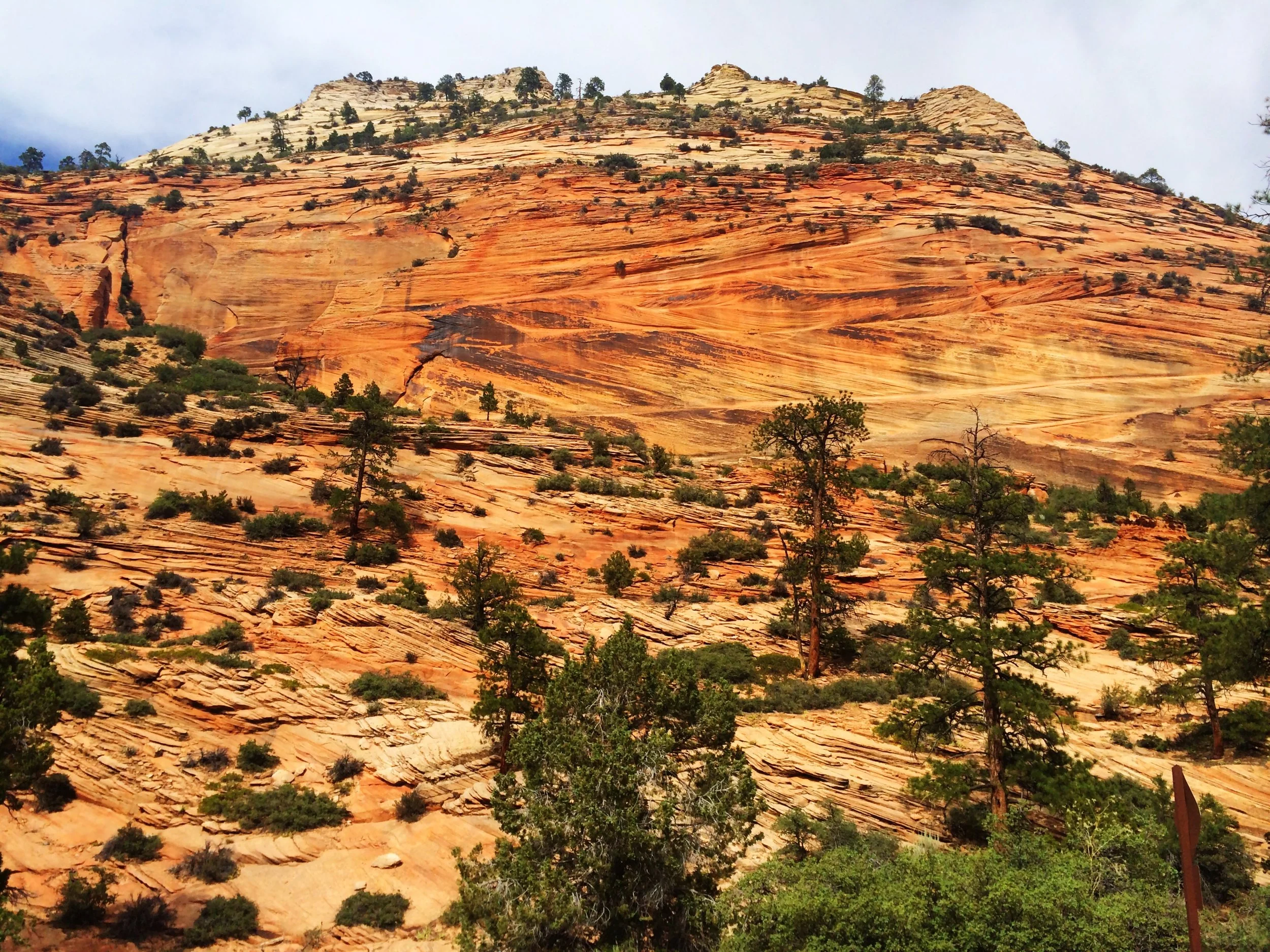
In a bit of blog magic, I am going to conflate two trips to Utah. I (once again with my other three family members) have since been to Zion in September 2015, and had the pleasure of tackling two of its other remarkable hikes. Zion is incredible. I love the vast scope and small scale. I love the aesthetic of orange and red oxidized mountains accented with greenery and brown gravel paved roads. It is a compact, bustling park with plenty to explore, including numerous hikes of varying degrees of difficulty. The most famous (as evidenced by the crowds that flock) are Angels Landing and The Narrows. I’m told the park and its surrounding topography resembles Cars Land at Disneyland. My brilliant dissertation-writing sister would call that phenomenon a simulacrum. The indefinable moment when the real thing calls to mind the fake thing and effectively reversing one’s mental free associations and replacing the bona fide with its falsified representation. So much of this trip reminds me of Disneyland, when in fact the “happiest place on earth” was modeled on these actual places. The La Quinta in Springdale was so good to us the first time around, we stay there once more.
Chapter Six:
The purpose (as if you need one) of this more recent trip was to further enjoy Zion and use its prime location as a staging area and homebase as we entered the daily permit lottery for access to the elusive and treacherous Wave hike in northern Arizona. The Wave, besides being heavily featured on the Instagram of @natgeotravel, is well-known among hikers and photographers for its colorful, undulating forms and the difficult hike required to reach it. Due to the fragile nature of the formation and the large number of people wishing to visit, a daily lottery system is used to dispense only ten next-day permits. Only in person. A map and information about the following day’s hike is supplied to those who have successfully obtained permits. In an effort to discourage unpermitted visitors the hiking trail is not well-marked and supposedly not patrolled. I’m hesitant to take the rangers at their contradicting word. How can they claim to monitor the hike for unauthorized users and yet not able to provide assistance to lost permitted hikers? In a nod to the past, you are expected to navigate the trail with just a map and compass. The hike is, according to some, so confusing and the conditions so arid that even skilled and permitted hikers have been known to get lost, dehydrated, and worse. For these reasons, the hike is extremely dangerous. And yet, for each of the next three days, we hope to be four of those lucky and brave few allowed entry.
This morning, my mom and I hang around the hotel pool, while my sister and dad drive to the visitor center in Kanab, Utah to enter the lottery for the following day. The lottery is held at the Grand Staircase-Escalante National Monument Visitor Center in Kanab, Utah (745 E. Highway 89, across from Walkers gas station and Wendy’s) from 8:30 to 9:00 a.m. One person per group is allowed to submit an application for permits. The lottery runs promptly at 9:00 a.m. and does not take long with just ten permits handed out.
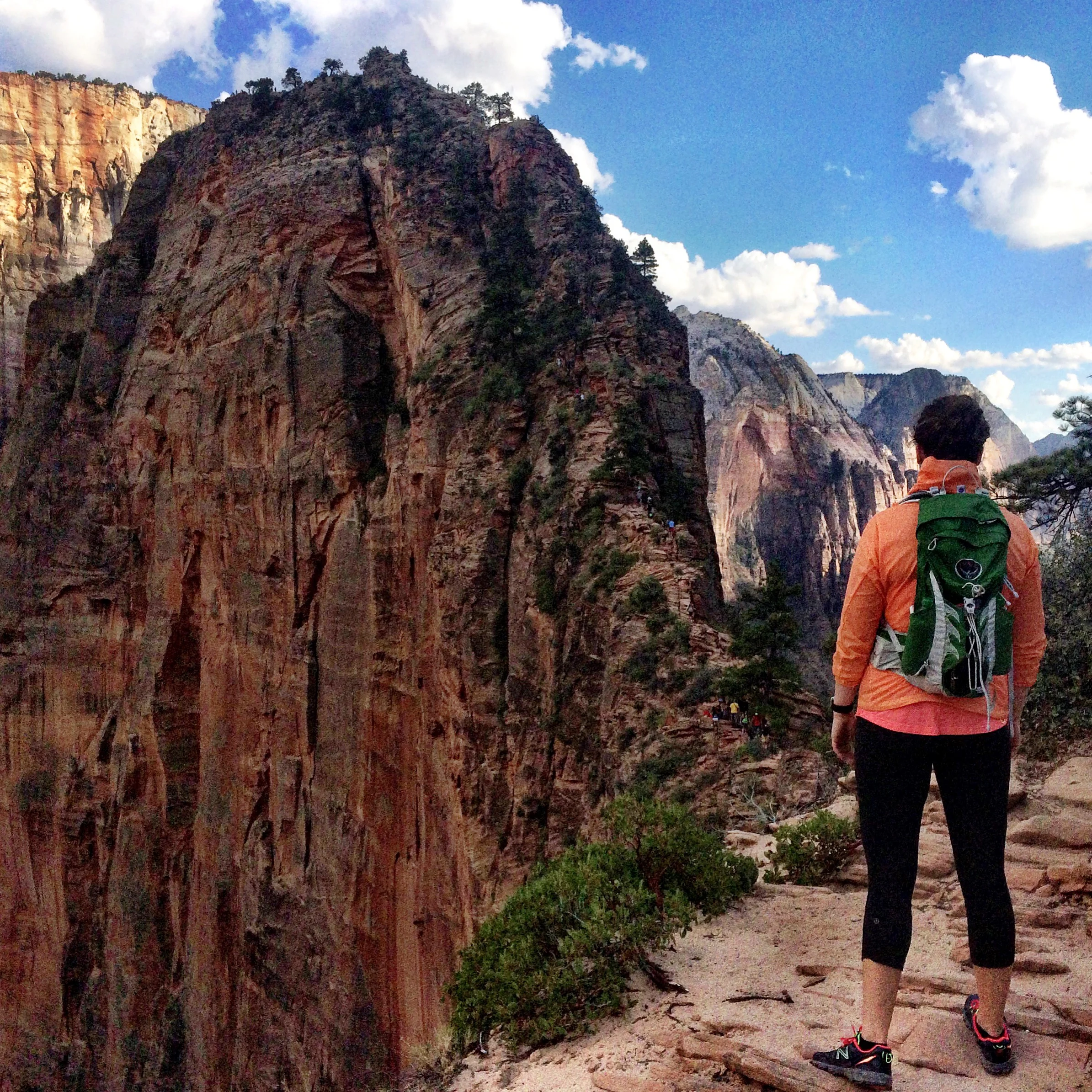
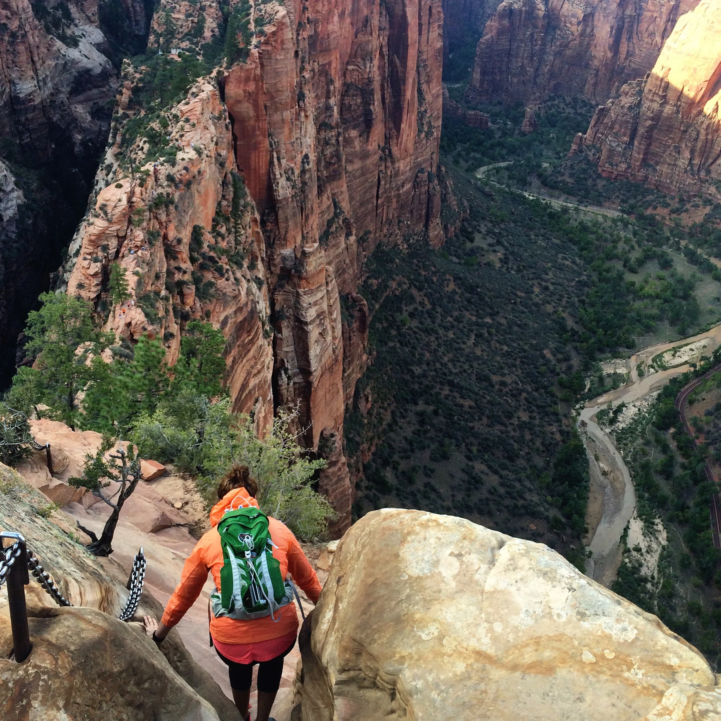
Upon their disappointing return, we head into Zion to hike Angels Landing. We take the Zion Park shuttle to The Grotto stop. Everything you have read is true. The hike is very crowded, very narrow, and quite scary. It is not advisable for young children or anyone fearful of heights. The last section is along a steep, narrow ridge to the summit with long drop-offs on either side. The hike is only five miles round trip, but takes much longer than the distance suggests, mostly due to waiting for groups heading in the opposite direction to pass by on the razor thin trail. There are many sections where the trail is not wide or secure enough for two people.
From the Grotto Picnic area, cross the Zion Canyon Road, and head toward the footbridge that passes over the Virgin River. On the other side of the bridge, take the north fork to the West Rim Trail. This busy path begins by traveling through a riparian woodland of cottonwood, pine and juniper trees. It’s a two-mile uphill trek as the trail ascends the steep West Rim Trail. Much of the path hugs the side of the mountain offering an outstanding vista of the shimmering river and billowy trees below. These first two miles are paved, wide and well-maintained. Most of the path is sunny and exposed, but Refrigerator Canyon offers shade and a cool breeze. This is a good early morning hike. I would assume the summit would also be an excellent vantage from which to watch the sun set. If starting late in the day, make sure to allow time to be off the trail by dark. We happened to go in the middle of the day, when hikers and heat both hit their peak.
Just before the trail spills onto Scout Lookout, it’s time to ascend the steep twenty-one sharp zigzag switchbacks to a scenic plateau. Walter’s Wiggles were named after the first superintendent of Zion who helped engineer the steep zigzagging section. The wiggles lead to a broad, sandy area called Scout Lookout. This is the saddle at the junction of the Angels Landing Trail and the West Rim Trail. The views down into Zion Canyon are impressive. Several climbing routes can be viewed from this vantage point. West Rim Trail continues, past Cabin Spring to Lava Point in the Kolob Terrace section of Zion, but the Angels Landing Trail turns southeast. Scout Lookout is a good place to rest and test your nerve for the challenges ahead.
The last half-mile is across a narrow sandstone ridge. Anchored support chains are attached along some sections of the ridge to assist hikers in navigating the uneven terrain. The narrow and arduous trail drops 1200 feet on one side and 800 feet on the other, so only look down when absolutely necessary! Upon reaching the summit, you will be treated to incomparable, expansive views of the entire valley: Narrows to the north and Court of the Patriarchs to the south. The Great White Throne seems only a stone’s throw away when standing at the end of the trail. Looking northeast across the canyon is Observation Point and to the east is Cable Mountain. While exploring Zion in 1916, Frederick Fisher exclaimed “only an angel could land on it,” and thus the monolith earned its moniker.
Like Kjerag before it, I did plenty of research on Angels Landing and its unique dangers and death rates. And once again, I found that the online photos and GoPro videos made the hike look scarier than it really was. The trail is very narrow (sometimes vertigo-inducing) and you will need to use the chains. There are other sections that are less on the edge but require more climbing and the ability to push yourself up and over boulders. The biggest challenge is staying calm and collected, especially in the face of other hikers passing you by, hikers who may be less steady than you.
That night, we enjoy excellent pizza (the white sun and Thai chicken) and ice cream. Insider tip: if you can’t choose a flavor, combine two different half scoops into one large single scoop portion.
Chapter Seven:
As is our custom, we rise and dine early. Our parents drop us at the Canyon Junction before continuing to Kanab to enter The Wave lottery. Meanwhile, my sister and I are hiking to Observation Point. We take the shuttle to Weeping Rock. Observation Point (8 miles round trip) shares the first part of the trail with the East Rim and Hidden Canyon Trails and branches off the Weeping Rock Trail at the trailhead. The path is steep and gains elevation quickly, making it one of the more strenuous hikes in the park. The Weeping Rock alcove can be seen during much of the hike and if you are lucky enough to be there after heavy rains (which we are not), several waterfalls might be visible. The Hidden Canyon Trail intersects the Observation Point Trail and takes off on its own at about the 1.5 mile mark. Hidden Canyon was closed during our visit. Several more switchbacks populate the ascent before the trail levels off as it leads into Echo Canyon, a deep gorge filled with water eroded sandstone pockets, similar to The Narrows.
Near the top of the trek you will see white rock; this layer is known as the Temple Cap formation. Beyond Echo Canyon, walls drop sharply, giving way to spectacular views. At the trail’s end, looking down into the canyon is a spectacular display of stone sculptures contrasted by the bluest of skies. From the 6,508 foot-summit, Angels Landing (so small and insignificant from this height!) and the West Rim are to the right. The Patriarchs stand at attention further down the right side of the canyon. The East Rim to the left showcases Cable Mountain, Great White Throne, and The Watchman at the far south section of the park. The Virgin River forms a lush river valley below, where water skirts around Angels Landing and the Organ, forming Big Bend.
Visitors are able to camp along the trail or rim. Any overnight stay requires a permit. Despite our early start, we saw a couple groups descending the trail after camping at the top. I was impressed and envious. I cannot even imagine how beautiful the sunrises and sunsets would be from Observation Point. We saw neither, but the views – of the valley and its native wildlife inhabitants – were still wonderful.
We rendezvous back at the hotel, taking time to lounge at the pool and jacuzzi. We enjoy a late lunch at our favorite local Mexican restaurant, Casa de Amigos. The service leaves much to be desired, the taco salad does not.
In the end, we did not win the lottery in Kanab. The Wave continues to elude my sister and I. But, after all the warnings and horror stories I heard second- and third-hand, I was more relieved than disappointed.
Chapter Eight:
Today is our last day. We depart early for Nevada. Once more, I will be leaving Las Vegas. Until now, we had two cars between the four of us. Allegedly, although perhaps we’ll never know, access to The Wave trailhead is best with a four-wheel drive equipped SUV. As a family of Priuses, we looked to rental car options just in case we won the lottery. When I arrived in Vegas late Friday night, I ended up with the most ridiculous rental: a blacked out, fully-equipped Yukon XL, more suited for Kimye’s entourage than a pack of dirty hikers. But that third row of seats sure came in handy when we need time away from the group!
Our final stop on the way out of town was the Fort Zion Gift Shop & Petting Zoo in Virgin, Utah. A veritable simulacrum of the old wild wild west made up of little building facades representing the town jail, bank, hotel, and saloon. Neither the tiny town nor its corresponding restaurant, gift shop, and petting zoo were open yet, but that felt right. It was a true ghost town. And with that, this exploration of real versus unreal was complete.

